Beaches Path June 2nd, 2018

This is the third path on our family challenge to walk the entire East Coast trail as a family this season. Previously we hiked Cape Spear Path (9.3 km) and Mickeleen’s Path (7.3 km). The idea is to knock off the easy hikes and progress to the more difficult ones. The biggest challenge will be for Emmeline who at the age of nine will really be stretching herself to complete some of the longest hikes.

I’ve decided I’m not going to go into great detail on the East Coast trail hikes. They are well documented on the Internet in other places. These postings are mostly to document our progress for our family and friends.

After a week of really terrible weather the sun finally broke out on Friday night. Saturday started as fog but the forecast called for clearing throughout the day before returning to crap on Sunday. Off we go.

Although the name of the path is Beaches you will be disappointed if you were expecting sand. It’s more of a rugged Newfoundland type of seashore. This pic was taken in the first hundred meters or so and was pretty typical of much of the terrain.

Image

Adrien was recently given a phone (despite my misgivings on giving a 12-year-old boy a portable screen). He’s been very creative with taking pictures and making short movie files. The irony is that I took all of these pictures on my phone.

Image

The rain from the last week seemed to have run off pretty quickly and the trail only had a few spots of deep mud to challenge keeping the feet dry. There were a lot of pretty little streams crossing the path throughout.

Image

I don’t know what to say about the next three pictures except: Wow! Tongue!

Image

Image

Image

Towards the end of the hike we stopped at a lookout at Herring Cove. We were lucky enough to spot a pair of Bald eagles. Here is where I wish I had brought a real camera. The phone images don’t crop and resize well. I’ve posted them here anyway but in reality these birds are huge.

Image

Image

Watching the people watching the eagles:

Image

On the drive home we stopped off at a roadside vendor and picked up a few fresh, live lobster. Got home and after some naps we murdered them quite mercilessly. They were delicious!

Image

Image

Image

Inside Hawke Hill Hike May 6, 2018


IMG_0583[1]May 6th 2018. This year Liane and I started the year with a trail NOT from the East Coast Trail. Instead we opted for an unknown trail that I had stumbled on while exploring the newly created power access roads by motorcycle.

I would leave 3-5 hours to walk to the top and return on a nice day. This was my first hike of my season, I was badly out of shape and was having breathing problems at the time so we were slow. We went further than the peak and exited after about 6 hours despite a little nap time and lots of breaks.

fb_img_1525690211813

I knew nothing about the trail when we started the day except that it followed a high ridge line. I only found out later that we were hiking to the highest point on the Avalon Peninsula on a day when the winds were gusting huge. Liane had to brace herself with her stick to avoid getting pushed around!

img_0581

Now that we’ve explored it I can tell you a little bit about it. It’s a beautiful trail that steadily heads south towards the wilderness area along an elevated ridge. like many elevated areas in Newfoundland it is essentially treeless. The resulting panoramas are  persistent, spectacular and 360 degrees. Erratics are in abundance in every direction.

FB_IMG_1525690175942


The trail starts near the Trans Canada Highway:

47°19’30.0″N 53°07’28.9″W

or thereabouts. Best Access is from the Power Access road via Witless Bay Line taking a west direction from there. This road is presently in fair shape and a normal car can safely navigate it if taking good care. Expect fist sized rocks on the road and some large puddles. Likely this road will deteriorate over time. Now that the construction is finished maintenance on the road will likely drop to zero. As one continues west the ridge will become obvious and you will see a cluster of cell phone towers and related radio equipment slightly to the right.


Capture

Here is a link to the topographic map that you can scroll around on: Hawke Hills full page map

The trail passes directly through the Hawke Hills Ecological Reserve. I can’t say anything about this. It seemed to me that it was just plain rocks in every direction and is a mere postage stamp of a reserve. Less than 100 meters square I would guess. Here’s a link to Newfoundsander’s write-up on the reserve. He certainly knows more about arctic plants than I.

The day starts out with rock, pure rock of every size. At the beginning the trail has been pulverized by quad traffic and there is no soil at all on the trail. just smallish rocks under your boots and around you. Moss in every direction. From your very first step the trail yields panoramic views but it does climb slowly up at an easy pace.

FB_IMG_1525689630936


The views just get better and better as you move away from the highway. Here’s a view of the terrain looking at the cell phone towers near the trail head. I believe we might actually be in the wilderness reserve at this point but it’s hard to tell:

IMG_0590[1]

The trail continues southward, undulating slightly with bog crossings here and there. Very manageable terrain but be careful to keep your feet dry in the bogs.

Inside Hawke Hill is pretty clearly the highest elevation around. You will have no problem finding it. The trail does continue past this point but fairly quickly becomes difficult to follow in the bog. The only person we met that day stopped to talk to us and informed us that the trail sort of comes and goes after Hawkes Hill but terminates at a high point called Mount Misery.


IMG_0584[1]IMG_0587[1]IMG_0578[1]IMG_0575[1]


Torbay to Flatrock

Getting Ready for a morning hike and afternoon paddle!

Getting Ready for a morning hike and afternoon paddle!

As usual all pics are linked to the original LARGE jpegs.

I stumbled on this trail while researching local MTB trails. It is rated as an intermediate MTB trail on http://www.mountainbikestjohns.com/index.php/news-and-events/23-mtb-st-john-s-site-launch which is a pretty good site despite being fairly new. I found it a struggle to get good info on trails here so I’m happy to have found this one. It may be intermediate if you are a 23 year old with a full suspension fatty tire MTB but it’s difficult on a hard tail hybrid with 90 psi tires. I’m looking at more aggressive treads but still….

The trail is an out and back affair and would/will normally start at Tappers Cove road. Tappers cove road doesn’t appear on my cellphone GPS so I couldn’t look it up. I had to google it. So to get there you would take Torbay road past Torbay. Make a right on Dumphy’s road and then a left on Tappers. The end of this road is a wharf and boat launch which the East Coast trail crosses through. There is parking there and you would take the stairs on the east side of the pier. Unfortunately the pier was destroyed in last winter’s storms and is now under construction. Access to the stairs is unavailable unless you would like to swim.

Too bad for me that I wasn’t aware of that. Not to be discouraged I just drove around keeping east until I found another access point at Gallows Cove road which is easily found by continuing northeast on Torbay road. It’s the second right after the Foodland.

There is limited parking at the Gallows Cove trailhead:

Image

The trail is initially in great shape. I unpacked the bike and got Soju under control as he was running around in excitement. Following Gallow’s Cove road it will bring you to the East Coast trail where you can turn left for Flatrock or right for Torbay. I turned left and rode through the ubiquitous spruce forest. Within the first 500 meters the forest petered out and entered rough farm land. The trail suddenly degraded from grassy or pine needles to loose, rounded rocks. For the uphills I had to get off the bike as I was unable to ride over the stones. Downhill was fun but challenging on a hybrid.

Let me take a minute to rant about Quads. These vehicles are the enemy of public trails. They rip up the soil, loosening it to the point that the everpresent rain washes the soil away. This leaves only the loose rocks that the quads throw around while they are gunning it up a hill. The trail depresses over time as the soil erodes and eventually just becomes a pile of rock. I’m not happy about that but I’m even more unhappy about that fact that once the trail becomes more or less unmanageable for a quad, the riders will just drive around the mess they have made on a new trail they make. So new trails are made which they destroy as well. I can see no effort on the part of quad riders on trail remediation or closing of trails for regeneration here. Bah! Worse still they run around in peat bogs that have been forming for centuries. Peat is waaaaaay more fragile than regular soil and the trail degrades into a pile of rocks inside of a year or two. Now there is no shortage of bog in newfoundland but it’s still an unpleasant looking mess of slop when they are finished riding around in it.

And I have no respect for the people who drive quads. If you hike or bike to the top of a hill you feel good; exhausted maybe, proud probably and you have a surge of lovely endorphins. If you ride a quad there guess what? You sat in a chair and a machine took you somewhere. No pride in that.

Anyway back to the story.

Here’s what the farmland looks like: a nice ocean view in the background:

CLICK TO ENLARGE!

After the farm the trail forks. You have the choice of going to Flatrock via Whale Cove or straight on. On the way out I went straight on and on the way back I went via Whale Cove. Whale Cove is the better route as it sticks to the shoreline and the trail has not been excessively degraded by 4 wheelers.

The straight through route continues up and down and there are three stream crossings. Nicely, the East Coast trail assc. has provided planks for safe walking which keeps the mud off of your boots and tires. After a bit it comes back to the Atlantic three quarters of the way up a sheer cliff face. As usual Soju displayed no fear of heights but freaked me out by wandering around the cliff edge. Here are a few pics of that cliff:

DSC_0069

From the top looking down

DSC_0070

Looking back towards Tor bay

DSC_0072

SOJU! Get your ass over here!

DSC_0068

Looking forward towards Flatrock. The path follows the edge of the cliff.

DSC_0073

Looking down to a path I have yet to try…..

DSC_0074

A Flock of Seagulls. Bad hair.

From this point on the trail becomes a single track and the quads have left the trail. That’s because on the other side of that cliff face you are forced to carry your bike occasionally. It’s much nicer here and the view spectacular on a nice day. I lingered here for a while hoping to see a whale or two but it’s still early in the season for that.

Another aside: May is iceberg season. Last year had an unusual amount of bergs coming south. This year not so much. June is whale watching season and the CBC gives reports on where the Capelin are “running”. Capelin are small fish a little larger then smelt and they move in enormous schools. I assume they are temperature sensitive as they aren’t here all of the time. They are the food of choice for whales so if you know where the capelin are you will often find whales gorging themselves. I’m looking forward to seeing some whales this year. There are numerous boats that take tourists out for whale watching which I think I will try this year. Here is a stock picture of what that is like:

English: Whales near Tadoussac, Canada Deutsch...
English: Whales near Tadoussac, Canada Deutsch: Wale im St. Lorenz Strom bei Tadoussac, Kanada Français : Baleines à proximité de Tadoussac, Canada (Photo credit: Wikipedia)


The trail continues as they usually do and finally comes to the “Beemer” at Flatrock. The Beemer is a long stretch of low rock. It’s fairly Barren so pretty good for riding around on . The town of Flatrock is nearby and there is another trailhead there. I didn’t capture this well with pictures as Soju was quite innocently scaring the crap out of a young lady from Peru doing a stint as a nanny. We ended up chatting a bit and walked part of the way back together. Soju wasn’t doing anything scary she was just scared to see a dog. Here’s those pics:

DSC_0075

The beginning of the Beemer

DSC_0076

Grampa Fatty rides a bicycle

The way back I walked a lot talking to Lisbeth about our experiences living in different countries. I took the whale cove route on the way back. Here’s what whale cove looks like:

DSC_0082

Whale Cove. The flat spot on the top is an awesome look out and could be camped.

DSC_0081

Note the crystal clear water!

And that’s about it for this trip. If you are enjoying the reads and pics please follow my blog and you will get an email notifying you of further posts. I have yet to write about my exploration of an old army outpost out here. I’ll get to it soon!

Eric


Kilbride to Petty Harbour First Ride of the Season April 27

This is a beautiful trail following what is left of Old Petty Harbour road. I imagine this road may have been the main road at one time. That must have been a long time ago because the road is slowly turning into a rugged ATV trail after the intitial kilometer.

The trail is about 7 km from end to end if you go down the big hill at Petty Harbour.  I recommend you don’t unless you don’t mind a long and difficult climb back up. If you want to have a look at the quaint fishing village of Petty Harbour (well worth a drive) then start at that end of the trail and drive up.

DSC_0051

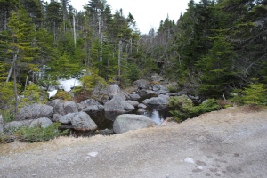
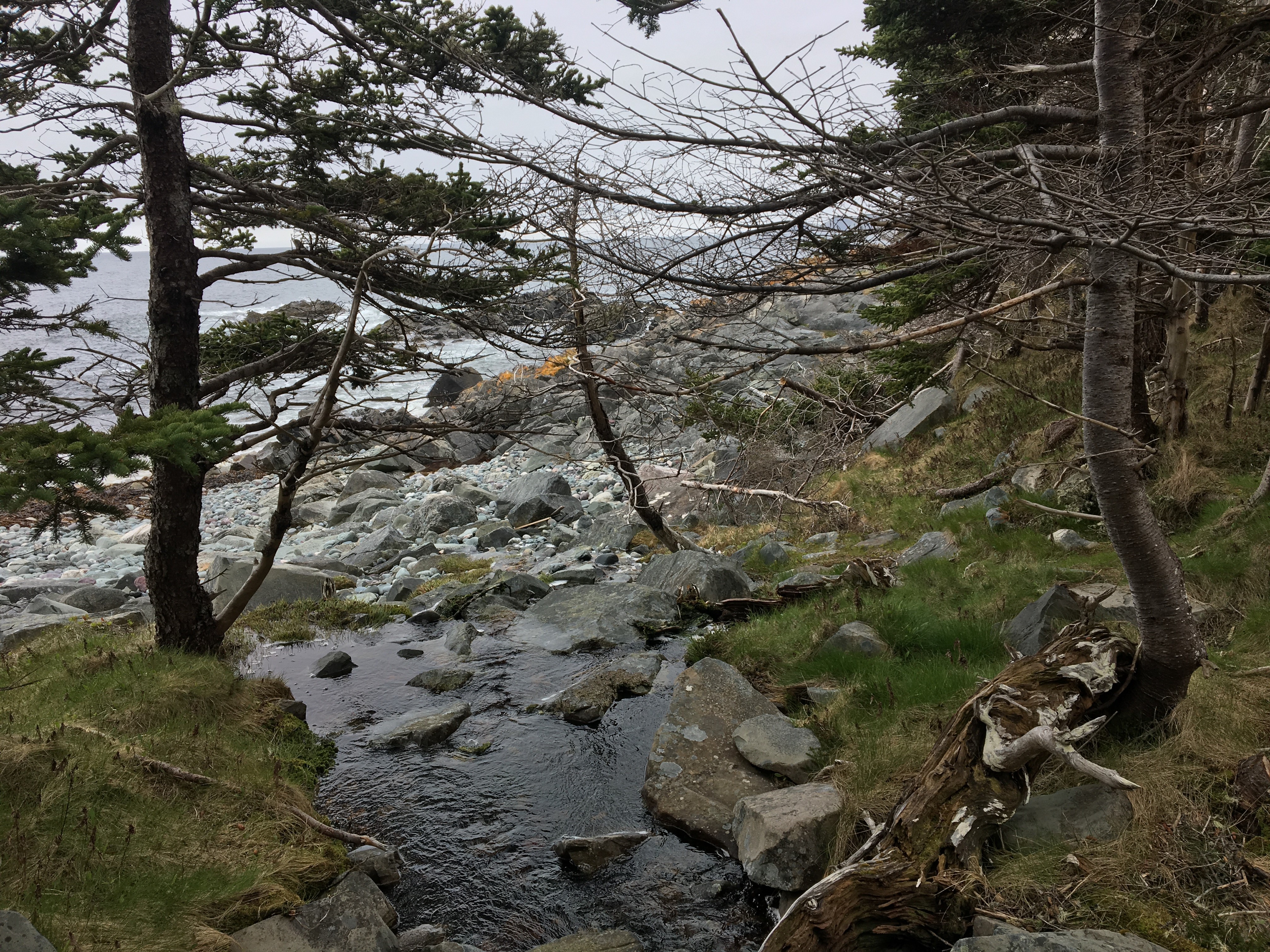
A stream connected to one of the first lakes

Today’s trip took me the better part of the afternoon (approximately 3 hours). It could probably be completed in the same time if one were to walk briskly with few breaks.  Indeed, I met a man there last summer who walks the trail regularly. Mind you when I walked beside him I realized I was almost into a jog!

The trail has quite a bit of variety throughout and many people opt for a shorter walk with kids or dogs. The trail lends itself to small kids as there are a lot of places that could be a “destination” for tired little ones and the first kilometer or so is level and well tended. The trail is not well known or at least it isn’t crowded. Today I saw 1 hiker and 2 ATVs and in the high season I would meet another hiker/biker only on the first few kilometers.

DSC_0050

One of the many pretty lakes

The many lakes provide excellent scenery along the way

I started about 2 or so after packing up and getting the rack on the back of the car. I have to get a roof rack bike attachment. These trunk affairs with the multiple straps are a pain in the ass and barely safe IMHO.

Soju took great interest in all this and obviously remembers bike rides. He jumped right into the car already excited. Driving from Paradise to Kilbride is a short trip. Taking the kilbride exit you will immediately turn left and then the first right on Old Petty Harbour road. Follow this road until the gate at the end. There is rough parking there and the street is legal also but rarely would you need to.

DSC_0037

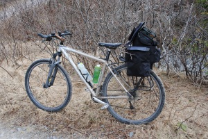
TUBES, WATER, PROTEIN BARS, RAIN GEAR, CAMERA, PUMP, SWEATER are required for this trip

The first kilometer or two are the most commonly used by locals and dog walkers. Within the first hundred yards you arrive at the first lake. The lakes here remind me of lakes in Ontario and this is a perfect example. Large rocks with spruce trees or baldly barren shores are typical here. This is a perfect trail for my bike and one makes great time. Picking a line is basically avoiding the puddle dips which contain the larger rocks.

The steel buildings I passed along the road are used to store dynamite. When I say steel I mean reinforced steel. I suspect they are designed to contain an explosion by blowing the roof off. The trail is pretty easy and I passed about three lakes before the road started to incline and get rougher.

Soju was so excited that we were cycling that he lead the way bounding along at 20 kph or so. Usually he runs beside or slightly to the rear of me. Not this time! He made up for all those walks I DIDN’T give him through the winter. I happily discovered that he is awesome at finding the right path. He avoids mud and water, seeks the most direct route, and avoids all but the very largest rocks preffering the sand or light gravel generally. He ran at least 2 k at a good clip before I got bogged down in hills and rocks. At the first stop he jumped right into the frigid water and started swimming!

The road is basically a dry stream bed here with large loose rocks

The trail progressed into thicker forest of fairly mature swamp spruce. The forest is quite dense and I began to encounter snow on the trail. For me that’s usually a get off and walk situation and this was no exception. I was rapidly crossing watersheds at this point so the shady side of the hills would have snow still. As I encountered more hills the trail took on the form of a creekbed. In many places water was still running down the road. This meant larger, coarser gravel and more unstable surfaces rapidly becoming fist to head size rocks either half buried or loose on the trail. For downhills I was able to navigate most of this. For the uphills I wasn’t able to power myself up the larger roaks so I pushed myself as far as I could and then walked until the road got better or another downhill started.

After several lake views the trees fall off to more typical Newfoundland scenery. Barren rocky hills with stunted trees and low brush allowing for unobstructed sweeping views. The road becomes very rough here as bedrock begins to show on the road.

To this point the trail had been going more up then down. Rather suddenly it went down into a peat moss bog. The bog has been pretty torn up by ATVs around the trail as they seek to find solid footing during wet weather. A little further away from the trail it’s actually quite beautiful. I figure the difference between a bog and a swamp is that you can actually walk across a bog which you really can’t do in a swamp. The bog will have watery places that you may possibly avoid. They share that the mud is deep and plentiful though. Apparently this bog becomes almost impassable with wet weather and many hikers turn back here.

BOG!

A bog is as good a destination as the seashore in my mind. I enjoy the birds and the stillness of a swamp or a bog so I sometimes make a swamp a destination for a day hike. I didn’t have to turn back though I did cover the bike and myself in muck.

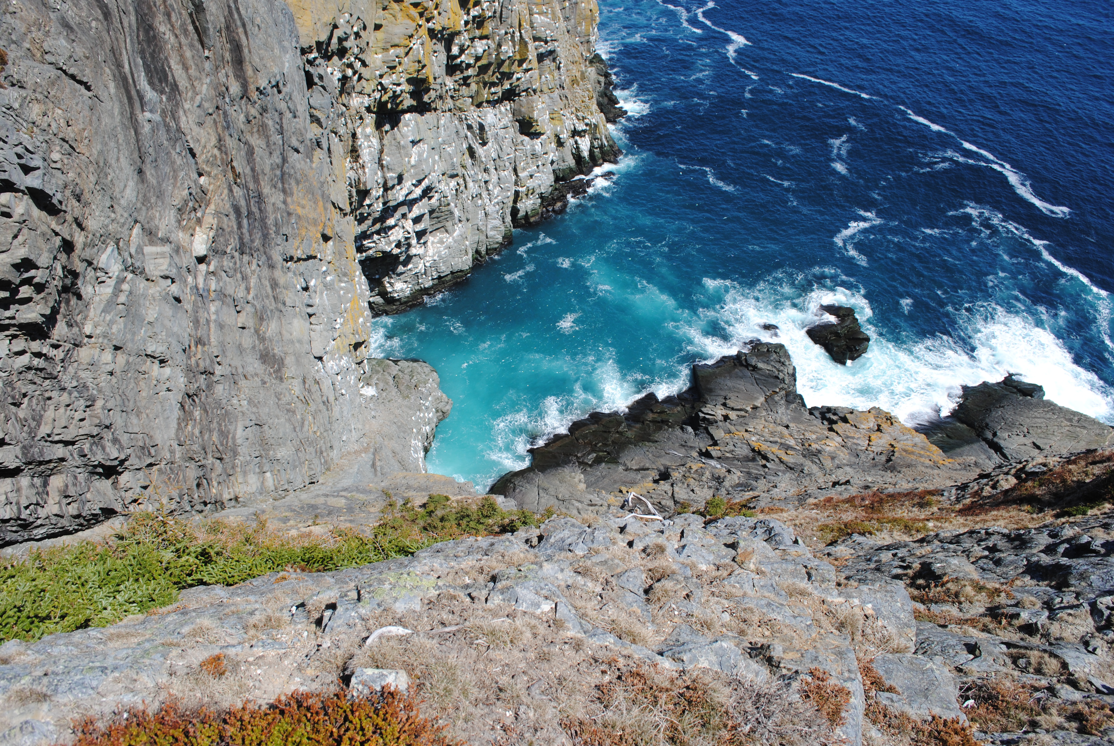
After the boggy bits there are a series of dammed lakes which offer excellent camping spots. They have obviously been used by someone previously. It was too early to test the water but there looked to be excellent swimming in these lakes also. It was here that I rested. In the distance I could see the ocean crashing against the coast. I went as far as the last lake which I had already been too when hiking previously.

On the return trip my legs were pretty rubbery. This is my first outing this year so that was expected. Soju was now running behind me when I could get up to speed. It’s nice when the last few kilometers are easy as it was on this trip.

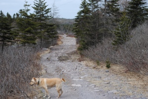
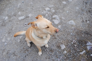
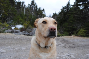
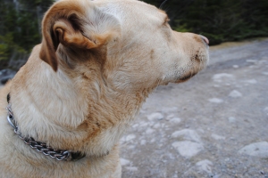
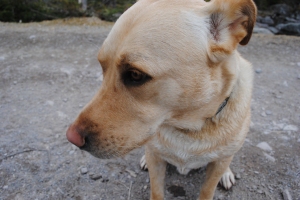
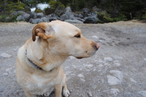
All in all a day well seized. I reccomend this route as a day hike or bike ride for beginner to intermediate riders. Today I learned to take many breaks to really take in the details and think about photos. There were many more pictures I should have taken to illustrate this story. Here are some random pics of Soju on this day:
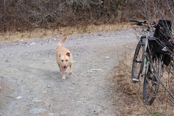
DSC_0036  DSC_0039

DSC_0052 DSC_0053 DSC_0054 DSC_0055 DSC_0056 DSC_0057